- Niantic Spatial is Niantic's geospatial AI division, built on a huge 3D world model generated from games like Pokémon GO and Ingress.
- Its Visual Positioning System (VPS) offers centimeter-level location using computer vision, overcoming many limitations of GPS in dense cities.
- The technology is already being used in delivery robots by companies like Coco Robotics and is aimed at logistics, industrial, augmented reality and even potential military applications.
- The use of data collected by players raises important debates about privacy, consent, and the exploitation of visual information from the physical environment.
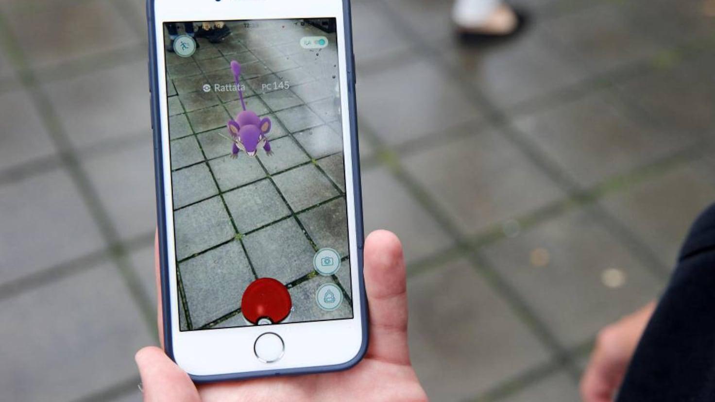
Niantic Spatial has become a key player in the new wave of artificial intelligence applied to the physical world . What began with millions of people hunting Pokémon on their phones has transformed, almost without many players noticing, into a vast infrastructure of 3D maps and computer vision that now guides delivery robots through the streets of major cities. Behind the joke of "go for a walk to catch a Pikachu" was a much more ambitious project.
While most people were just watching an augmented reality video game, in the background, the largest geo-anchored view dataset on the planet was being compiled . Scans of PokéStops, short videos of statues, plazas, and buildings, and photos of all kinds of urban spaces have allowed Niantic to build a geospatial model of the world with centimeter-level resolution. Today, that work has been separated from the game and exists under a new name: Niantic Spatial.
What exactly is Niantic Spatial?

Niantic Spatial is the technology company resulting from the separation of Niantic Inc.'s video game business . Starting in 2025, Niantic divided its operations into two branches: Niantic Games (with titles such as Pokémon GO, Pikmin Bloom, and Monster Hunter Now), which was sold to the mobile gaming giant Scopely; and the unit focused on artificial intelligence, mapping, and augmented reality, which became known as Niantic Spatial.
The new company defines itself as a geospatial AI firm . Its goal is to understand and represent the real world with centimeter-level accuracy so that machines, robots, autonomous vehicles, and augmented or mixed reality devices can reliably locate themselves and interact with their environment. What Niantic Spatial offers is not a simple map, but a living, three-dimensional, and constantly updated “model of the world.”
To support this project, Niantic Spatial relies on a colossal database: more than 30.000 billion geolocated images , captured primarily in urban environments around the world. Much of this imagery comes from Pokémon GO and Ingress, but also from other apps, developers, and surveyors who collaborated with the company. This is complemented by their own advancements in computer vision , Gaussian scattering for 3D reconstruction, and various scanning tools.
The corporate structure has also changed completely. Niantic Games was acquired by Scopely in a deal valued at approximately $3.500 billion, plus an additional $350 million in cash for Niantic shareholders. Niantic Spatial, on the other hand, remains an independent company, led by John Hanke and with base funding of approximately $250 million ($200 million from the former Niantic and $50 million from Scopely).
With this move, Niantic makes it clear that its future strategy is no longer so much about publishing massive mobile games, but rather about becoming the leading company in geospatial AI . Its current projects continue: the Visual Positioning System (VPS or SVP), its computer vision platform, the Scaniverse ecosystem, and the development of augmented and mixed reality experiences such as Hello Dot for MetaQuest 3 and Peridot Beyond for Snap's Spectacles glasses.
How the Niantic Spatial 3D map was built
The core of Niantic Spatial is its Large Geospatial Model , a large-scale geospatial model capable of understanding real-world scenes, relating them to millions of previously viewed scenes, and deducing the structure of a place even if it hasn't been fully scanned. This model wasn't created in a closed laboratory, but rather on the streets, thanks to the widespread use of scanning features in games like Pokémon GO and Ingress.
For years, Niantic included an option in its games that asked users to record short videos of PokéStops, gyms, and other points of interest . These "scanning" tasks were optional, but heavily integrated into the experience: players were encouraged to explore monuments, unique buildings, squares, parks, and iconic areas, and to record their surroundings with their mobile phone cameras in 180- or 360-degree views.
The official Pokémon GO help documentation explained in detail how to perform the scans : move around the object or location, maintain a reasonable distance and height, and capture the scene from different angles to ensure the reconstruction was as accurate as possible. According to the company, the images were processed anonymously, blurring faces, license plates, and other identifiable elements to reduce privacy risks.
The result, after years of data collection, is a three-dimensional world map with a resolution and level of detail far superior to that of a traditional map . It's not just GPS points or street plans: it's complete scenes, with buildings, street furniture, signs, trees, lampposts, and benches, accompanied by highly accurate metadata.
Each of these clips or images includes information such as camera angle, time of day, lighting and weather conditions, device orientation, movement speed, and exact location . This combination allows Niantic's model to know not only "where" something is, but also how it looks in different circumstances and how it fits into the larger structure of the city.
In 2022, the company was already publicly discussing a map created from over 100 million video clips submitted by players, developers, and surveying teams. However, that figure was just the beginning: today, Niantic Spatial boasts over 30 billion images and operates its visual positioning system in more than 1 million mapped locations worldwide.
From massive video games to global infrastructure
When Pokémon GO arrived in 2016, the concept seemed simple: go outside with your phone, stroll around your neighborhood or the city center, and catch virtual creatures that appeared in squares, parks, monuments, and iconic buildings. Augmented reality was presented as a fun layer over the physical world, something that encouraged you to walk more and discover places you might not have noticed before.
However, from quite early on, Niantic began to hint, to almost anyone who would listen, that its long-term vision extended far beyond entertainment . In 2020, it acquired the startup 6D.ai to accelerate the development of a dynamic 3D map of the planet and strengthened its tools for capturing and recording the environment in real time.
That acquisition was key because 6D.ai worked precisely on reconstructing physical spaces in three dimensions from video and sensor data. Adding this capability to the massive user base of Pokémon GO and Ingress, Niantic had all the ingredients to become a global geospatial infrastructure provider.
Between 2020 and 2022, the company began to rely much more explicitly on the player community to collect visual data from PokéStops, Gyms, and other key locations. Scanning tasks were integrated as in-game missions, rewards were offered, and players were encouraged to actively participate in improving the augmented reality experience.
For a while, the message was that this data would primarily serve to make Pokémon GO's augmented reality more accurate and stable : better tracking of virtual objects, more believable Pokémon placement in the environment, and fewer errors when overlaying digital elements onto real buildings or surfaces. Today, with the emergence of Niantic Spatial, it's clear that this was just the first phase of something much bigger.
In November 2024, Niantic publicly unveiled its Large Geospatial Model and explained that its visual positioning system was already operating in over a million specific locations around the world. The promise was that this leap would be useful not only for augmented reality glasses, but also for robotics, content creation, autonomous systems, and, in general, any application that needed to accurately understand the physical world.
The Visual Positioning System (VPS) and why it is so important
The technological heart of Niantic Spatial is its Visual Positioning System (VPS) . While GPS uses satellite signals to calculate location, VPS relies on what the camera sees: it compares the images captured in real time with the detailed visual maps that the company has built from the scans.
In practice, this means that a device—whether it's a mobile phone, augmented reality glasses, or a robot—can position itself in space with centimeter-level accuracy simply by analyzing the physical reference points around it: building corners, lampposts, signs, shop windows, street furniture… Anything that appears in the database can be used to “anchor” the position.
The great advantage of VPS over GPS is that it overcomes many of the limitations of satellite technology in dense urban environments . In cities with skyscrapers or very narrow streets, GPS signals bounce off building facades, degrade, or are lost, which can lead to errors of tens of meters. For a person using a map app, this deviation is usually annoying but tolerable; for an autonomous machine, it's a serious problem.
Niantic Spatial presents its VPS as a complement to, and in many cases a replacement for, traditional GPS when maximum accuracy is required. Instead of relying solely on satellite coordinates, autonomous systems can use this visual layer to refine their position, even when GPS signals fail completely.
According to the company itself, what makes its approach different is not just the computer vision technology, but the scale and level of detail at street level . Few companies have managed to gather so much visual data so close to the ground, from so many angles, and under so many different conditions of light, weather, and time of day. And much of that achievement stems, once again, from the massive success of its games and the—often not entirely conscious—collaboration of its communities.
Niantic Spatial and Coco Robotics: from catching Pokémon to delivering food
All this work is no longer just theory or future promises. Niantic Spatial has begun to apply its VPS in very specific scenarios , and one of the most striking is its alliance with Coco Robotics, a startup based in Santa Monica, California, that deploys small autonomous robots to deliver food and retail orders.
In February 2026, the two companies announced a collaboration to integrate Niantic Spatial's Visual Positioning System into Coco's delivery robots . These vehicles, which already operate in neighborhoods of cities like Los Angeles, Chicago, Miami, and Helsinki, have several integrated cameras (around four) that record their surroundings as they travel along sidewalks and streets.
Thanks to Niantic's VPS, the robots can compare in real time what their cameras see with the database of images collected over years by players and other contributors . This allows them to pinpoint their location with remarkable accuracy, even in situations where GPS is unreliable: between tall buildings, in challenging pickup areas, at intersections with poor coverage, or at delivery points with difficult access.
This approach allows Coco's robots to make over half a million deliveries with a level of accuracy that would be difficult to achieve using GPS alone . The visual system helps them avoid going to the wrong door, maneuver safely, and complete routes even if the satellite map shifts them several meters from their actual position.
In Niantic's words, no single data source defines its model : while game scans were the initial foundation, increasingly, data generated directly by customers—like Coco Robotics—feeds and refines the system in the areas that matter most to them. It's a continuous cycle: the more robots that use the VPS in an area, the better the visual maps of that area become.
Geospatial AI: Beyond Delivery Robots
The alliance with Coco Robotics is just the tip of the iceberg of what Niantic Spatial aims to achieve. The company's goal is to become the reference geospatial layer for all types of intelligent systems that interact with the physical world . Potential uses range from logistics and advanced navigation to industrial augmented reality, urban maintenance, and even military applications.
From the AI perspective, many large technology companies have realized that Language Models (LLMs) are very good with text, but have a poor understanding of the physical environment . They can answer questions, write code, or generate summaries, but they lack "experience" with street layouts, neighborhood organization, or the obstacles a robot might encounter on any given sidewalk.
Niantic's technology acts as a "fabric" connecting visual and spatial information with AI applications . Its world model is a kind of three-dimensional dictionary where every place is described by millions of visual examples, environmental conditions, movement patterns, and cross-references. This type of representation is key for future physical AI—robots, autonomous vehicles, drones, AR glasses—to navigate the world with common sense.
It's not hard to imagine large logistics operators like Amazon or transportation companies like Uber being interested in these kinds of highly accurate maps to optimize routes, deliveries, and pickups in complex areas. It's also possible that there are less "friendly" clients, such as actors in the military or security sectors, interested in extremely detailed world models for their own purposes.
Meanwhile, Niantic Spatial continues to drive the development of augmented and mixed reality experiences based on this same geospatial model. Apps like Hello Dot for the Meta Quest 3 or Peridot Beyond for smart glasses allow digital content to be overlaid onto the real environment in an increasingly stable, precise, and believable way—something unthinkable without a solid 3D map underneath.
Minimum ages and access to Niantic Spatial games and apps
With Niantic's transformation into a company focused on geospatial data and AI, age-based access policies for its products have become more relevant . Not all of its apps are aimed at children or teenagers, and the processing of information about the physical environment raises specific data protection issues.
For games and applications directly managed under the Niantic Spatial umbrella— AR Voyage, Ingress Prime, Niantic Spatial Recon, Peridot, Scaniverse, Into the Scaniverse, and Hello Dot , among others—the rule is clear: minors cannot access or play them. The company establishes specific age thresholds by region, in accordance with personal data protection regulations.
For residents of the European Economic Area (EEA) , a minor is considered to be anyone under the age of 16, or under the age required to consent to the processing of personal data in their country of residence (which may vary between Member States). In the Republic of Korea , the age limit is 14.
In the rest of the world, the reference point is anyone under 13 years of age or the age required to consent to the processing of their personal data according to local regulations. This means that even if a minor has the technical capacity to use the game or app, they should not legally do so if they do not reach that age threshold.
These requirements are not mere formalities: Niantic Spatial's applications work with highly sensitive data about the physical environment , including images of public spaces and, potentially, elements that could be considered personal data. That's why the company insists on establishing clear age limits and emphasizing the optional and anonymized nature of the scans wherever they are collected.
Privacy, consent, and social debate
The use of data generated in games like Pokémon GO to power Niantic Spatial's AI has sparked intense debate about privacy, consent, and environmental surveillance . Although the company maintains that the scans were always voluntary and anonymized, many players claim they never had a clear picture of how those images and videos would actually be used.
Niantic's terms of service stated that images captured in the app could be stored as "map data ," which, from a legal standpoint, gave them free rein to build this geospatial model. However, in practice, almost no one reads the fine print of a free mobile game before playing, and the company is fully aware of this.
The revelations published by outlets like MIT Technology Review have led many people to reconsider the "implicit agreement" they had accepted . What was presented to users as a fun task to enhance the game's augmented reality has become the foundation of a technological infrastructure with enormous commercial value, potential interest for logistics giants, and possibly for government or military actors.
Critical comments have gone viral on social media, such as: “143 million people thought they were just catching Pokémon, when in reality they were building one of the largest real-world visual datasets in AI history .” Other users have pointed out that the real genius wasn't building the map, but designing incentives for millions of players to work for free, collecting edge cases and data waste without them even realizing it.
Niantic, for its part, emphasizes time and again that participation in the scans was and remains completely optional , that submissions are processed without linking them to individual accounts, and that faces, license plates, and other features that may be directly associated with a specific person or vehicle are erased or blurred.
Even so, the expansion of these highly detailed three-dimensional maps reopens the debate about what level of environmental surveillance we are willing to accept . It's not just about what the company sees and stores, but about who will have access to that data and for what purpose. The potential military uses mentioned in some analyses completely change the nature of the original "offer": a free game in exchange for data that is now worth its weight in gold.
From playful fieldwork to the physical AI revolution
Everything surrounding Niantic Spatial illustrates an increasingly clear trend: video games and consumer apps have become massive data factories . What seemed like mere entertainment has actually been a gigantic distributed fieldwork effort, in which millions of users have mapped the world zone by zone, corner by corner, for almost a decade.
For the industry, the result is incredibly appealing: a detailed, vibrant world model perfectly scaled to the machines' capabilities . For many gamers, however, the feeling is bittersweet, as if a data collection effort with never fully explained implications had been disguised as a game.
The truth is that Niantic Spatial's technology opens the door to a new generation of autonomous systems that no longer rely solely on GPS and 2D maps. Delivery robots, drones, light vehicles, augmented reality glasses, and even urban maintenance tools will be able to use these models to operate with a precision and understanding of the environment that until recently sounded like science fiction.
At the same time, pressure is mounting on companies and regulators to be more transparent about data use, especially when it's collected through massive gaming experiences. Knowing exactly what data is stored, for how long, with whom it's shared, and for what purposes will become increasingly important for maintaining public trust.
Niantic Spatial ultimately represents the evolution of a company that started by taking us out into the streets to catch virtual creatures and now aspires to be the invisible infrastructure that guides robots, glasses, and AI systems through the real world . The same energy that drove us to walk miles for a glowing Pikachu is what, unbeknownst to many, was fueling one of the most ambitious geospatial platforms of our time.


Passionate writer about the world of bytes and technology in general. I love sharing my knowledge through writing, and that's what I'll do on this blog, show you all the most interesting things about gadgets, software, hardware, tech trends, and more. My goal is to help you navigate the digital world in a simple and entertaining way.