- Google combines Flood Hub and Groundsource to predict river and flash floods using advanced AI models.
- Flood Hub uses hydrological and flood models based on satellite and historical data to anticipate river floods up to seven days in advance.
- Groundsource uses Gemini to turn millions of news stories about urban flooding into structured data and issue alerts 24 hours in advance.
- Both tools are integrated into Google Search and Maps to democratize access to early warnings in more than 80 countries and 150 urban regions.
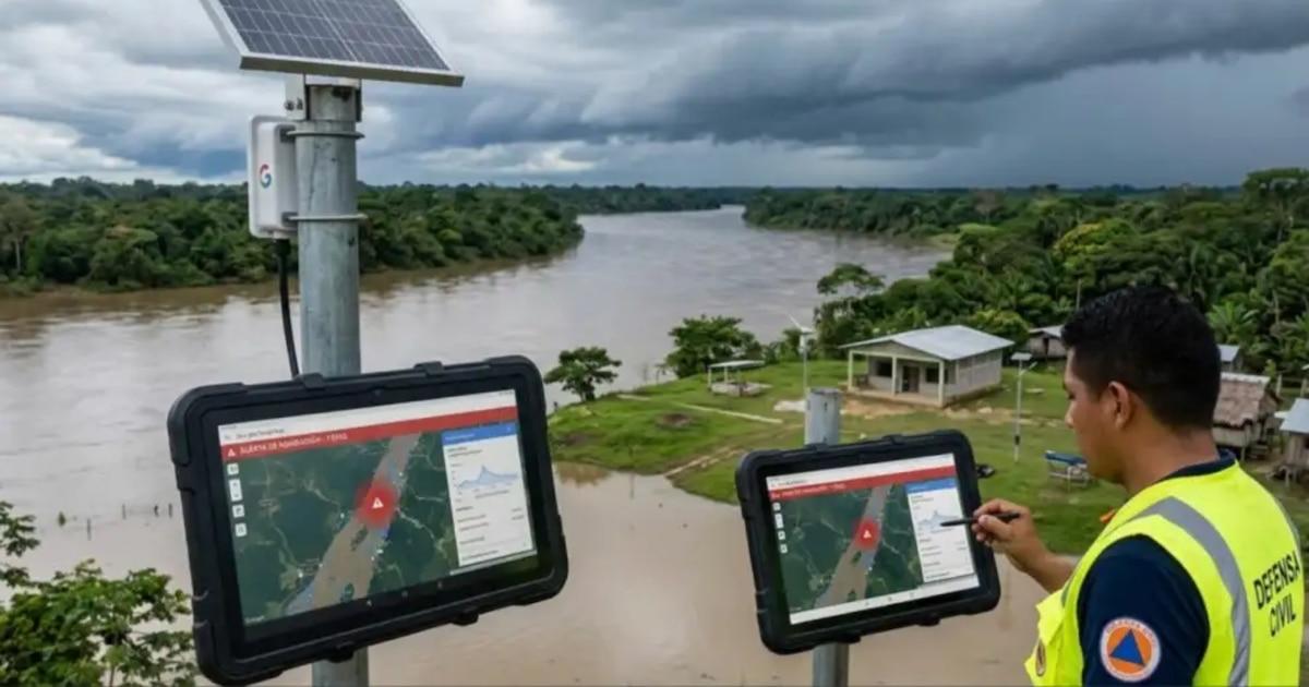
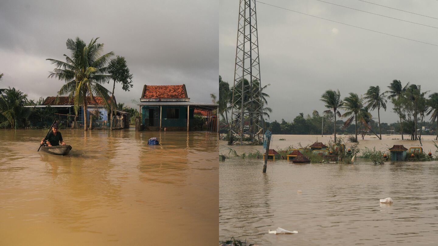
Floods, both river floods and flash floods in cities, have become one of the most frequent and deadly natural disasters in the world . Each year they cause thousands of deaths and millions of dollars in losses, especially in regions with few weather stations or early warning systems. In this context, artificial intelligence has gone from being a futuristic promise to a practical tool for anticipating risks and saving lives.
In recent years, Google has made significant strides in this area with two key pillars: Flood Hub, its global platform for predicting river flooding up to seven days in advance, and Groundsource, a system that uses Gemini to predict urban flash floods 24 hours ahead . Both initiatives are part of its climate resilience program and are designed primarily for countries with virtually no physical sensor networks or advanced radar systems.
Flood Hub: Google's platform for anticipating river floods
Flood Hub is an online platform that combines deep learning models, satellite data, and hydrological simulations to predict river behavior before they overflow. Its mission is simple to understand but very ambitious: to offer reliable forecasts where there is virtually no meteorological infrastructure, and to do so free of charge and on a global scale.
Google has expanded Flood Hub's coverage to include 80 countries and approximately 460 million people , with a particular focus on regions in Africa, Asia, and Latin America. Many of these areas experience heavy rainfall, flash floods, and river overflows, but lack local monitoring stations to provide sufficient advance warning of these events.
The Flood Hub interface has been designed to be easy to use for citizens, authorities, and civil protection teams . Through interactive maps, the platform displays color-coded risk zones that indicate different levels of danger, allowing users to see at a glance which areas could flood, when, and with what approximate severity.
In addition to the web platform, Google has integrated these alerts into Google Search and Google Maps . This means that if someone is in an area prone to river flooding, they can receive warnings directly in the search engine or while using the navigation app, without needing to visit any specific website.
How Flood Hub's AI models work
The heart of Flood Hub rests on two large artificial intelligence models that work in a coordinated manner . Each one deals with a different part of the hydrological problem, but both feed into each other to offer the most complete forecast possible.
First, there's the hydrological model , which estimates river flow. To do this, it analyzes variables such as expected rainfall, soil moisture, terrain type, and topography . Based on this information, the AI calculates how much water will ultimately flow through the riverbeds and when dangerous levels will be reached.
Second is the flood model , whose role is to transform the projected flow into a map of areas that could be flooded. This model estimates which specific areas will be affected, how the water will spread, and how high it could reach over areas of approximately 20 square kilometers , allowing for the identification of towns and neighborhoods at risk.
To train these models, Google uses large volumes of public data, historical flood records, and numerical simulations . Unlike traditional systems that rely on sensors installed in every river, Flood Hub uses a technique known as transfer learning : the AI learns in well-instrumented basins and then applies that knowledge to regions where data is scarce.
This strategy enables the platform to generate useful forecasts in locations where flow meters or rain gauges have never been installed. In this way, communities that previously lived virtually in the dark about flooding now have advance information to make emergency decisions.
Advantages, global reach, and current limitations of Flood Hub
One of Flood Hub's greatest achievements is that it prevents countries from having to invest in expensive and complex measuring equipment . Data processing takes place in Google's data centers, where millions of satellite images, terrain elevation measurements, and global weather forecasts are analyzed.
Thanks to this cloud-based architecture, the system has achieved unprecedented levels of accuracy for a free, public tool . Google Research reports highlight that the main objective is to democratize access to information critical to civil security, reducing the economic barriers that prevent many governments from deploying state-of-the-art infrastructure.
During initial trials in India and Bangladesh , the system allowed for more timely preemptive evacuations. Those extra hours—or even days—can make the difference between a chaotic operation and an orderly evacuation, especially in densely populated areas where a flash flood can leave thousands of people trapped.
However, Google acknowledges that the technology still has significant limitations . Flood Hub is primarily optimized for river flooding , caused by overflowing rivers, and its performance is lower when it comes to flash floods in urban areas , resulting from intense storms, drain collapses, or saturated drainage systems.
Another significant limitation is spatial resolution . Currently, many forecasts are generated at scales of around 20 square kilometers, which is useful for regional planning but less precise at the neighborhood or street level. Despite this, the system is constantly evolving, with plans to integrate new variables such as glacial melt, deforestation, and changes in soil absorption capacity.
Groundsource: Google's bet on urban flash floods
While Flood Hub was created to address the problem of relatively predictable river flooding , Groundsource focuses on the more elusive aspect of the issue: flash floods in cities . These events are extremely localized, short-lived, and incredibly deadly, causing more than 5.000 deaths annually worldwide.
The major problem with flash floods is that they leave hardly any trace in traditional instrumental databases . There aren't enough sensors, many stations don't record such local details, and in much of the world, there simply isn't a standardized observation network that rigorously collects data on these events.
To overcome this data bottleneck, Google has opted for an idea as simple as it is ingenious: using news and public reports as raw material for data science . This is how Groundsource was born, a tool that uses Gemini, Google's language model, to track and analyze information on urban flooding around the world.
The company explains that Groundsource draws on publicly available information about 2,6 million floods recorded since 2000 in more than 150 countries . This data comes primarily from press articles, official reports, and other open sources that, until now, had been used more as qualitative accounts than as quantitative data for training models.
With this approach, Google aims to address the significant lack of quality historical records, transforming unstructured news into an organized archive of events , with dates, locations, and characteristics precise enough to feed advanced predictive models.
How Gemini uses news to build a reliable database
The process Groundsource follows is quite meticulous. In the first phase, Gemini reads millions of newspaper articles and public reports , identifying which ones contain information about actual urban flooding.
Next, the AI applies a multi-stage verification process . The first is the classification phase , in which the system distinguishes between real flood events, news about ongoing events, references to past floods, or mentions that do not correspond to a specific weather event.
Next, temporal reasoning comes into play . Gemini analyzes publication dates, verbs, and the text's context to determine, as precisely as possible, when each flood occurred . This allows vague journalistic accounts to be transformed into well-defined points in a timeline.
The third stage is spatial accuracy . Here, the model identifies the location described in the news report—neighborhoods, cities, nearby rivers, approximate coordinates—and assigns it on the Google Maps Platform . Subsequently, another Google Maps system helps to define the geographic boundaries of each event, that is, the approximate area that was actually underwater.
At the end of this process, a database called Groundsource is obtained, which is a geolocated time series of urban floods . The key point is that we are no longer dealing with simple journalistic accounts, but with structured data that can be processed as if it had been measured by physical instruments, including date, location, and severity.
Data quality and results obtained with Groundsource
A key issue when using news as a source of scientific data is reliability . Google details that, after applying all filters and verifications, 60% of the extracted events were accurate in both location and time , meaning they correspond very well with the reality documented by other sources.
Furthermore, approximately 82% of the events achieved a level of accuracy sufficient to be truly useful in practical contexts, such as urban risk analysis, infrastructure planning, or hazard mapping . In other words, it is not a perfect database, but it is robust enough to train models on a global scale.
The company also highlights that Groundsource was able to capture between 85% and 100% of the severe floods recorded by the Global Disaster Early Warning and Coordination System (GDACS) between 2020 and 2026. This demonstrates that the system not only detects major, high-profile disasters, but also less visible, high-impact events.
Thanks to this historically rich dataset, Google trained a new predictive model that significantly improves urban flash flood forecasts up to 24 hours in advance . This is precious time to activate emergency plans, close roads, alert the public, and coordinate rescue services.
These urban flash flood forecasts are already integrated into Google's Flood Center , along with Flood Hub's river flood forecasts, thus expanding the reach of alerts and preparedness for extreme events.
The predictive model: neural networks and hyperlocal forecasts
Once the Groundsource database was created, the next step was to train a forecasting system specifically for flash floods. To do this, the researchers used LSTM (Long Short-Term Memory) neural networks , which are widely used in problems where time and data sequence are critical.
This model processes global weather forecasts, topographic information, and historical flood data extracted from news reports . Using this combination, it calculates the probability of a flash flood occurring in a specific area within the next few hours and generates alerts up to a day in advance.
Unlike conventional systems based solely on physics, this hybrid approach combines atmospheric dynamics, terrain features, and historical event data. External research, such as that conducted by the University of Michigan with the U.S. National Water Model, suggests that integrating AI can improve prediction accuracy four to six times compared to purely physical models.
However, Google's own team emphasizes that the model doesn't yet achieve the accuracy of the best national warning systems that use near real-time local weather radars, such as the US National Weather Service. In many regions, these radars simply don't exist, and that's where Google's proposal becomes particularly relevant.
In this sense, Groundsource's design is geared towards operating in contexts where advanced infrastructure is sorely lacking . It doesn't aim to replace more sophisticated systems where resources are available, but rather to bring reasonable predictive capabilities to places that, without this type of AI, would still lack any viable early warning system.
Social impact, institutional collaboration and climate resilience
Both Flood Hub and Groundsource are part of Google's climate crisis response and resilience strategy . The company has worked in collaboration with local governments and international organizations to validate data, adapt risk maps to the realities on the ground, and ensure that alerts are integrated into national emergency protocols.
In many developing countries, the lack of weather stations, radars, and river sensor networks severely limits the ability to anticipate extreme weather events. By offering an AI-based solution that doesn't require large investments in local hardware, Google aims to bridge this gap and democratize access to vital information.
Furthermore, the alerts integrated into Google Search, Google Maps, and Android notifications allow information to reach citizens through channels they already use daily. There's no need to install special apps or visit specific websites, which greatly increases the likelihood that the alert will reach the right people on time.
Company officials, such as Yossi Matias, Vice President of Engineering and head of the crisis response program, have emphasized that artificial intelligence can be a key tool in addressing the challenges of climate change , especially in resource-constrained contexts. Google's Flood Forecasting Initiative is a prime example of how technology can translate into lives saved and damage prevented.
In parallel, Groundsource's success demonstrates the potential of language models to transform unstructured information—such as old news reports—into actionable data . This approach is not only useful for floods: it opens the door to developing similar models for other natural hazards such as droughts, landslides, or avalanches, using historical reports that have been largely untapped until now.
Together, the combination of Flood Hub, Groundsource, and associated AI models creates a technological ecosystem that changes how we understand, measure, and anticipate floods . Thanks to AI, areas that previously barely appeared on risk maps now have concrete tools to better prepare for increasingly extreme weather.


Passionate writer about the world of bytes and technology in general. I love sharing my knowledge through writing, and that's what I'll do on this blog, show you all the most interesting things about gadgets, software, hardware, tech trends, and more. My goal is to help you navigate the digital world in a simple and entertaining way.